History
A history of real estate in Christiansburg.
How the county’s land became town lots, how a railroad depot made a second town, how the houses climbed the hills, how a school’s farm was sold and subdivided, and what homes have cost, from the first lots of the 1790s to this year’s sales.
180
Acres in the 1792 town
County land, laid off in lots and streets
$14,300
Median home value, 1970
Census, owner estimates
$252,600
Median home value, 2020-24
Census survey, owner estimates
$317,250
Median sale price
Last 12 months
Chapter 1
1790 to 1833
Lots and streets.
Christiansburg began as county property. When the General Assembly established the town on November 10, 1792, the land it named was 180 acres belonging to Montgomery County, the ground where the courthouse and the other public buildings stood, already laid off into lots and streets. Nine trustees were put in charge of it.
The same act set the terms of ownership. A buyer who failed to build on a Christiansburg lot in the time the law allowed could lose it, and the trustees could take the lot back and sell it again for the benefit of the town. The trustees could also make rules for the regular building of houses and settle disputes over lot lines.
The plan was two streets and a square. Main Street and Cross Street, now Franklin Street, were laid out 60 feet wide and met at a public square 264 feet across, and those elements of the plat of 1790 to 1793 are still in place. In 1813 a third street, First Street, was laid out one block south of Main; for years it was called Long Alley.
The trustees were still selling lots as late as 1827. One sale can be followed: a lot on the hill east of the square was bought from the town in 1812, sold in 1817, and is now the site of the Barnett-Montague House on East Main Street, one of the oldest houses in town.
Chapter 2
1790 to today
Where the deeds are kept.
Every deed in Montgomery County is recorded in Christiansburg, the county seat. The county’s clerk’s office of 1812 stood on the square; it was later absorbed into the Phlegar Building, which the county took down in 2020 to make room for a magistrates’ building.
The deed books carry the town’s real estate history in their own words. Deed Book 5, page 81, records the land given for the railroad depot north of town. A 1916 deed in Deed Book 65, page 563, calls a cottage on Zion Hill “our residence property.” The 1947 deed that turned Christiansburg Institute’s campus over to three public school divisions is in Deed Book 151, page 54.
The same chain of deeds is what a title search follows when a home changes hands today. The county’s online parcel map and real estate records are the place to start; the deeds themselves are recorded with the Clerk of the Circuit Court.
Chapter 3
1851 to 1908
Lots at the depot.
The railroad made the town’s second real estate venture. In 1851 the Virginia and Tennessee Railroad chose a site along Crab Creek about a mile north of the courthouse; steep grades kept it from coming closer. Rice D. Montague, the county clerk, gave the land for the depot and the right of way, expecting to profit as the land around the depot rose in value.
The first sales came quickly. In 1855 Montague sold a parcel just south of the tracks to a merchant, Daniel A. Brown, who bought the next lot in 1869. In the 1869 deeds Montague set aside an open space at the depot to stay open for the public forever: the depot square.
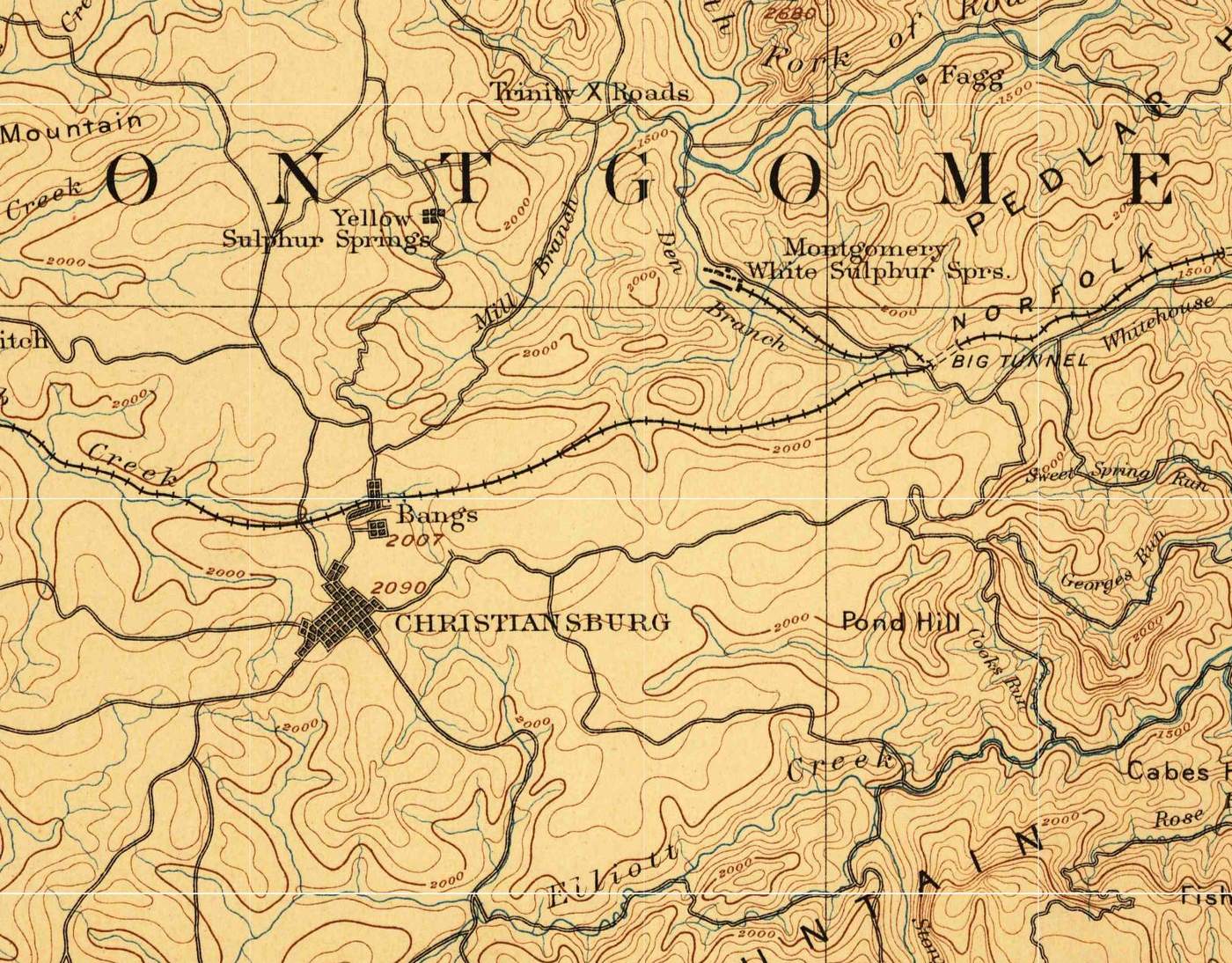
Brown, one of the village’s first developers, built a brick house beside his store. When he died in 1900 his land south of the tracks was divided into lots. In 1908 businessmen from Riner and Christiansburg bought the Brown lots, took down the old store and built a brick wholesale grocery facing the square, with a bank building beside it. Rebuilt in part after a fire in 1947, they are the Surface-Lee Block.
Montague’s own land between the town and the depot was subdivided by his family. Gray’s map of Christiansburg, from the late 1870s, labels it Montague’s Addition.
Chapter 4
1877 to 1930
Houses up the hill.
Between 1900 and 1910 the town’s population grew from 659 to 1,568, probably on the strength of industry near the railroad, and much of the new building went up between the town and Cambria. East Main Street, the old road to Salem on the hill northeast of the square, filled with houses on large lots with deep front yards: Queen Anne houses, one with a turret, Shingle Style and Colonial Revival houses, and simpler center-passage and T-plan houses on Park Street.
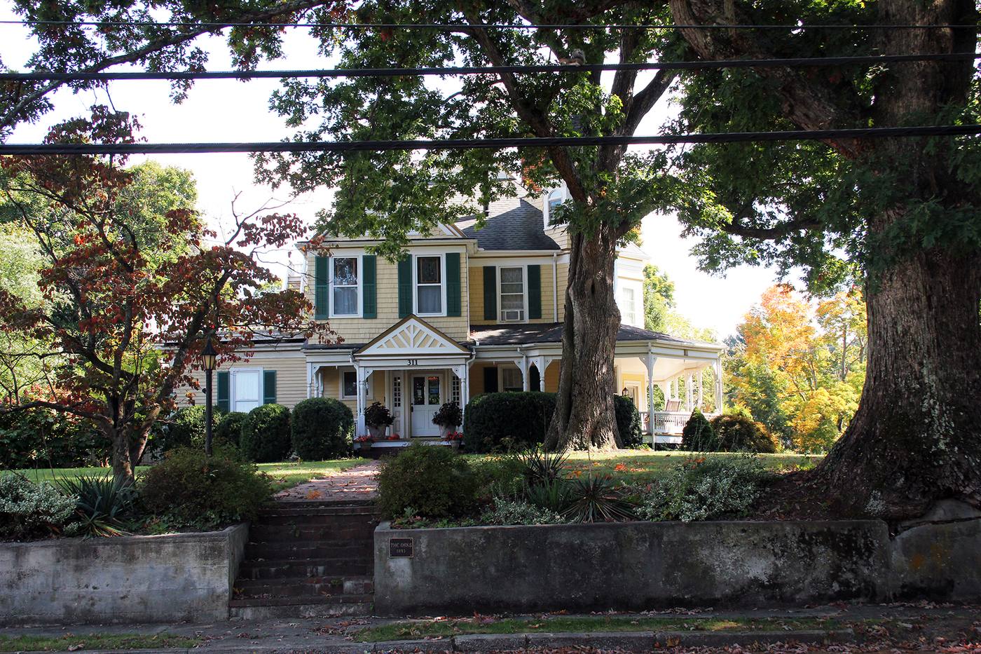

One East Main lot shows how the land was divided. The Oaks, a Queen Anne house built in 1893, sat on 4.58 acres in 1894. By 1903 the lot was 3.128 acres, and by 1920, 2.68. As the land shrank, its assessed value fell from $1,500 to $300 by 1941. By 1994, when the house was listed on the National Register, it stood on 1.2 acres and served as an inn; the rest of the land had been sold and developed.
The streets were rebuilt for the new houses. Retaining walls of stone and concrete along East Main appear to date from a street grading of the early 1900s, and in the 1920s a row of brick bungalows went up high above Pepper Street. On South Franklin Street the land beyond the mid-1800s Miller House was subdivided and built on gradually from the late 1800s into the mid-1900s; one house there, The Huts of 1919, is built of round rooms. In Cambria two matching bungalows were very likely ordered from a mail-order catalog in the 1910s, one of the ways the railroad brought precut houses within reach.
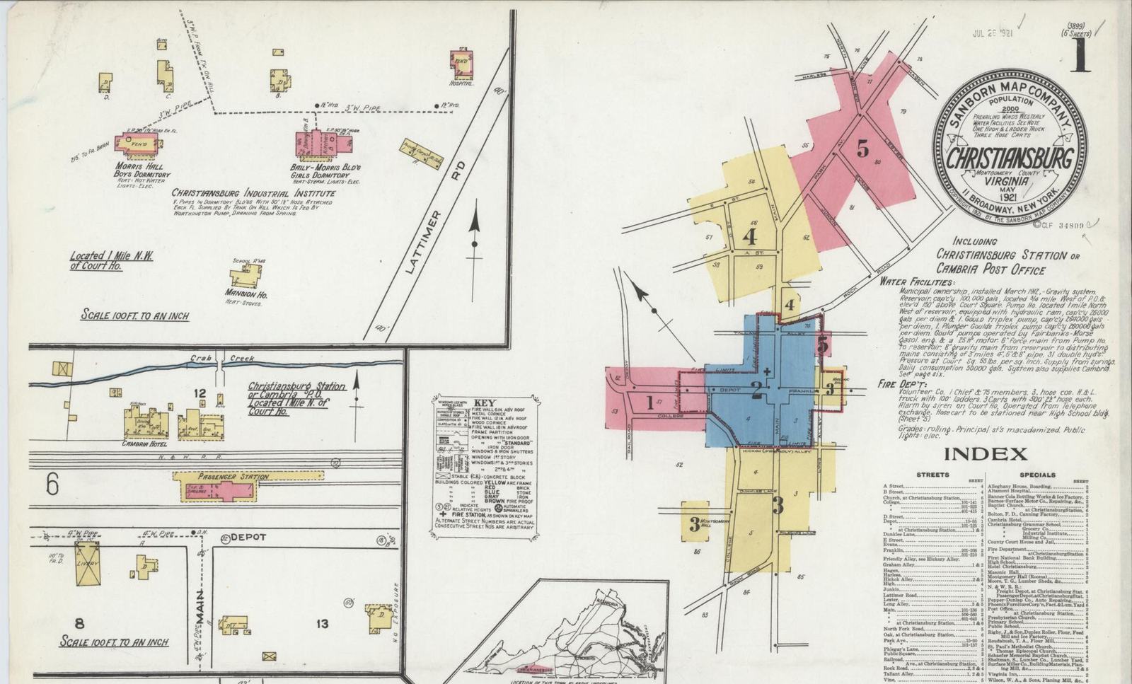
Utilities followed. The fire insurance maps of 1885 called the town’s water supply not good. By May 1921 the town owned a gravity water system, installed in March 1912 and fed by springs, which also served Cambria; its main streets were macadamized and its public lights were electric.
Then the road moved. When a new route of the Lee Highway bypassed East Main Street, the National Register nomination records, the street became a quiet backwater.
Chapter 5
1898 to 2000
A school’s farm.
Some of the land west of downtown has a history all its own. Christiansburg Institute, founded in 1866 as a school for freedpeople, bought 87 acres on the north bank of Crab Creek, west of its first building on the hill, in 1898 and 1899, and 85.63 more acres of farmland in 1905. The farm campus grew to hold dormitories, classroom buildings, shops, a dairy and a barn.
In 1947 the campus was deeded to the school divisions of Montgomery County, Radford and Pulaski County, on the condition that it keep operating as a high school for Black students. When the county desegregated its schools, the Institute’s last class graduated in the spring of 1966. In 1967 the school board sold the property, over the objections of Black residents of the county, and the land was subdivided and sold off.
One building survives on its original site: the Edgar A. Long Building of 1927, on Scattergood Drive west of North Franklin Street. From 1986 to 2000 parcels of the old campus, including the Long Building’s, were donated to the school’s alumni association. The Long Building has been on the National Register of Historic Places since 2001.
Further reading: Christiansburg Institute, Inc. (museum and archives)
Chapter 6
1940 to today
Subdivisions.
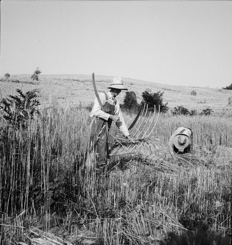
Between 1940 and 1960 the town’s population grew from 2,299 to 3,653. Then the town grew outward. In the 1960s it annexed parts of the surrounding Riner and Shawsville districts and consolidated with the Town of Cambria, and by 1970 more than half of its 7,857 people lived in areas added since 1960. In 1975 it annexed another 3.03 square miles, adding 1,072 people.
The town also had a say over land it did not yet govern. From 1961 its subdivision rules applied within two miles of its limits: no private streets, connection to town water and sewer where they were available, fire hydrants where water lines ran, and town street standards. By 1986 those rules covered all of the land the town next proposed to annex.
Sewer drew the next line. In 1986 the town asked to annex 7.96 more square miles, land that held about 13 subdivisions, a shopping mall under construction, an idle glass plant and a good deal of farmland. In one part of Belmont Estates, a county study had found in 1980 that 22 of 23 lots platted in 1977 had soils that would not take a septic system, and the county’s wastewater study named Belmont Estates and Belmont Farms among the six areas in Montgomery County most in need of sewer lines. The state’s Commission on Local Government recommended a somewhat smaller annexation in 1987, and the Town planned to extend sewer to those subdivisions within three years.
Much of today’s town was farmland within living memory, and the names say so. Belmont Farms came into the town limits in 1988, Spradlin Farms began to be developed for shopping in 2000, and the former Harkrader Farm came in with a boundary adjustment in 2009, all by the Town’s account; in 2013 the town bought the 63 acres of farmland that became Huckleberry Park.
The records show the order in which the town filled in. Grouped by the decade in which most of their homes on record went up:
- 1940s: Lee Hy Court and Victory Heights.
- 1950s: Roseland Heights, Lynwood Terrace, Highview Terrace, Beverly Hills and Sullivan Heights.
- 1960s: Suburban Hills, Oakwood, Huff Acres and Belmont Farms.
- 1970s: Rolling Hills, Viewland, Lester Place, Cumberland Forest, Echo Hills and Blue Ridge Court.
- 1980s: Franklin Parke, Falling Branch Townhouses, Hans Meadow, Harman Forest, Country Meadow Estates, Atkinson Acres, Henley Place and Sleepy Hollow and 3 more.
- 1990s: Pepper Street Townhomes, Ridinger Acres, Wheatland Hills, Kamran Drive, Grand View Estates, Arrowhead Estates, Ridgeway Farms Estates and Warren Heights and 6 more.
- 2000s: Diamond Hill South, Stafford Farm, Cornerstone Townhomes, Charleston Place, Huff Heritage, New River Village, Hunters Ridge and Overlook Court and 14 more.
- 2010s: Robin Hood Estates, Senneca Springs, Sturgill Estates, Kensington and Cambria Crossing.
- 2020s: The Meadows, Clifton and Reagan's Pointe.
These groups count only homes that have been listed or sold since 2005, and a neighborhood appears only where one decade holds most of its homes. Each neighborhood page has the full count, decade by decade, under How it was built.
The homes standing today tell the same story. Of about 11,271 homes in town, the Census estimates 1,803 were built in the 1990s and 1,793 in the 2000s, more than any other decades.
Homes standing today, by decade built
All 11,271 housing units in the town, houses and apartments alike. Census Bureau, American Community Survey 5-year estimates, 2020 to 2024.
Chapter 7
1969 to today
Where the stores went.
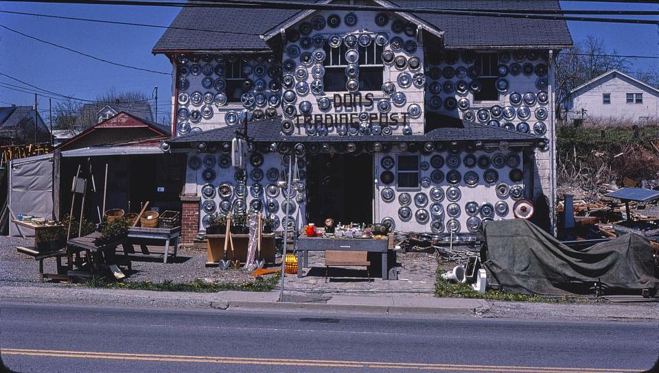
Commerce left the square in steps. The town’s first shopping center, Hill’s Plaza on Roanoke Street, opened on October 15, 1969. Rose’s closed its downtown store in the late 1970s, and downtown answered with the Old Town Mall in the mid-1980s. In 1988 Leggett’s department store moved from Main Street to the newly built New River Valley Mall north of town.
The mall made North Franklin Street and Peppers Ferry Road the shopping district for the whole New River Valley. By the Town’s account the 1988 annexation took in the mall site while it was still under construction, and the district kept growing: Spradlin Farms from 2000 and the New River Center in 2007. The mall’s owner renamed it Uptown Christiansburg in 2020.
Land near the corridor has also gone to public use. The town’s Recreation Center opened on North Franklin Street in 1997, the Huckleberry Trail was extended from the mall in 2010, and in 2013 the town paid $2.5 million for 63 acres of former farmland off Peppers Ferry Road. That land opened as Christiansburg Huckleberry Park in 2023.
Chapter 8
1990 to today
Owners, renters and rules.
Most of Christiansburg’s homes are lived in by their owners, though a smaller share than a generation ago. In 1990, 67.5% of occupied homes in town were owner-occupied; the Census estimates 59.8% for 2020 to 2024, 6,131 of 10,253. The town counted 10,715 homes in the 2020 Census, up from 6,267 in 1990.
Four historic districts carry the town’s oldest buildings. The East Main Street, South Franklin Street and Cambria districts were listed on the Virginia Landmarks Register in 1989 and the National Register of Historic Places in 1991; the Downtown Historic District followed in 2013. Listing brings recognition, not local rules: the Town has no historic review board and no added design regulations for its districts.
See what's coming to Christiansburg: new development and projects in the works, and follow what Town Council is deciding.
Homes in Christiansburg at each census
Housing units counted inside town limits by the decennial census.
Chapter 9
1970 to now
What homes have cost.
The Census asks owners what their homes would sell for. In 1970 the median Christiansburg owner put the value at $14,300. In 1990 it was $65,300, in 2000 $101,600, and in the Census Bureau’s 2020 to 2024 survey $252,600. In every period with a county figure, Christiansburg’s median sat below Montgomery County’s.
These are owners’ estimates of what a home would sell for, not sale prices, and they are not adjusted for inflation. The 1970 to 2000 figures cover one-family homes on less than 10 acres with no business on the property; the survey figures cover all owner-occupied homes. No 1980 figure is shown: we could not locate that year’s Virginia housing tables.
Median home value, Census
| Census | Christiansburg | Montgomery County |
|---|---|---|
| 1970 | $14,300 | Not shown |
| 1990 | $65,300 | $71,800 |
| 2000 | $101,600 | $114,600 |
| 2006-10 survey | $172,700 | $187,600 |
| 2011-15 survey | $178,500 | $205,100 |
| 2016-20 survey | $197,400 | $230,000 |
| 2020-24 survey | $252,600 | $304,600 |
1970, 1990 and 2000: decennial census, one-family homes on less than 10 acres with no business on the property. Ranges such as 2020-24: American Community Survey 5-year estimates, all owner-occupied homes.
What homes actually sold for.
Census values are estimates. Sales are the record. This is the median price of every Christiansburg house, townhome and condo sale on record, by year, from 2006 through 2025.
| Period | Median sale price |
|---|---|
| 2006 | $173,326 |
| 2007 | $173,856 |
| 2008 | $170,000 |
| 2009 | $170,500 |
| 2010 | $162,500 |
| 2011 | $158,000 |
| 2012 | $164,000 |
| 2013 | $169,000 |
| 2014 | $171,750 |
| 2015 | $167,000 |
| 2016 | $180,000 |
| 2017 | $179,900 |
| 2018 | $196,500 |
| 2019 | $205,450 |
| 2020 | $234,000 |
| 2021 | $250,600 |
| 2022 | $284,000 |
| 2023 | $301,000 |
| 2024 | $315,000 |
| 2025 | $322,400 |
- From 2006 through 2016 the yearly median barely moved: it stayed between $158,000 and $180,000.
- It first reached $200,000 in 2019 and $300,000 in 2023.
- The biggest one-year rise came in 2020: 14%, from $205,450 to $234,000.
- In 2025 the median home sold for $322,400, 86% above 2006. These prices are not adjusted for inflation.
$320,000
2026 so far
346 home sales
430
Homes sold
Last 12 months
See the market month by monthSee recent salesWhat is my home worth?
Timeline
Real estate, year by year.
From the first lots to the newest rules.
Before 1800
1790
The survey
The new county seat is surveyed on May 21.
1792
180 acres
The town is established on county land already laid off into lots and streets.
The 1800s
1812
A lot on the hill
A lot east of the square is bought from the town; the Barnett-Montague House stands there.
1813
First Street
A third street is laid out a block south of Main.
1827
The last town lots
The trustees are still selling lots.
1851
A depot site
The railroad chooses a site on Crab Creek a mile north of the courthouse.
1855
The first depot lot
Land beside the tracks is sold to a merchant.
1869
The depot square
An open square at the depot is set aside for public use.
1870s
Montague’s Addition
Land between the town and the depot is subdivided.
1893
The Oaks
A Queen Anne house is built on East Main Street, on what becomes a 4.58-acre lot.
1898
A school’s farm
Christiansburg Institute begins buying land on Crab Creek.
The 1900s
1900
The Brown lots
Land south of the tracks at Cambria is divided into lots.
1908
Surface-Lee Block
A wholesale grocery and a bank rise on the depot square.
1912
Town water
A spring-fed water system serves Christiansburg and Cambria.
1919
The Huts
A house of round rooms goes up on South Franklin Street.
1920s
Pepper Street
A row of brick bungalows is built above the street.
1947
A campus deeded
Christiansburg Institute passes to three public school divisions.
1965
One town
Christiansburg and Cambria are consolidated, after annexations in the early 1960s.
1967
The campus sold
The Institute’s land is sold, then subdivided.
1961
Rules past the line
The town’s subdivision rules begin to apply two miles beyond its limits.
1969
Hill’s Plaza
The town’s first shopping center opens on Roanoke Street.
1975
Annexation
The town annexes 3.03 square miles and 1,072 people.
1977
Lots without sewer
Lots are platted in Belmont Estates; a 1980 study finds most cannot take a septic system.
1988
The mall
The New River Valley Mall opens; an annexation takes in Belmont Farms.
1991
Historic districts
East Main Street, South Franklin Street and Cambria join the National Register.
The 2000s
2009
Today’s boundary
The latest boundary adjustment takes effect on April 30.
2013
Park land
The town buys 63 acres of farmland for Huckleberry Park.
Sources
Every historical fact on this page comes from a source below, read on the date shown. Most come from the National Register of Historic Places nominations for Christiansburg’s historic districts and landmarks, the acts of the Virginia General Assembly, and Census Bureau publications. Where sources disagree or a record could not be checked, the fact is left out or the disagreement is noted. Census figures are the Census Bureau’s; sale prices come from local sales records. Something to add or correct? Tell us.
Every source was checked on October 14, 2026.
- William Waller Hening, The Statutes at Large of Virginia, vol. 13 (1823): the 1789 act dividing Montgomery County (pp. 77-78) and Chapter 71 of the October 1792 session, an act for establishing several towns (p. 585)
- National Register of Historic Places nomination: South Franklin Street Historic District (Gibson Worsham; VLR 1989, NRHP 1991), Virginia Department of Historic Resources file 154-0010
- National Register of Historic Places nomination: Christiansburg Downtown Historic District (2013), Virginia Department of Historic Resources file 154-5025
- National Register of Historic Places nomination: East Main Street Historic District (Gibson Worsham; VLR 1989, NRHP 1991), Virginia Department of Historic Resources file 154-0001
- Virginia Department of Historic Resources: Phlegar Building (154-0007)
- Montgomery County Circuit Court Clerk: deeds and land records (recorded in Christiansburg)
- National Register of Historic Places nomination: Cambria Historic District (Gibson Worsham; VLR 1989, NRHP 1991), Virginia Department of Historic Resources file 154-0048
- National Register of Historic Places nomination: Christiansburg Depot, now the Cambria Freight Station (1985), Virginia Department of Historic Resources file 154-0048-0001
- National Register of Historic Places nomination: Surface House (1989), Virginia Department of Historic Resources file 154-0043
- National Register of Historic Places nomination: Edgar A. Long Building (2001), Virginia Department of Historic Resources file 154-5008
- National Register of Historic Places nomination: The Oaks (1994), Virginia Department of Historic Resources file 154-0001-0005
- Virginia Department of Historic Resources: The Oaks (154-0001-0005)
- Sanborn Map and Publishing Company, Christiansburg, Va., December 1885, 1 sheet (Library of Congress, Sanborn Maps Collection)
- Sanborn Map Company, Christiansburg, Montgomery County, Virginia, May 1921, sheet 1 (Library of Congress, Sanborn Maps Collection)
- National Register of Historic Places nomination: Old Christiansburg Industrial Institute (Hill School) (1979), Virginia Department of Historic Resources file 154-5004
- Tracy A. Martin, Black Education in Montgomery County, Virginia, 1939 to 1966 (master’s thesis, Virginia Tech, 1996)
- Cardinal News: “Christiansburg Institute to host fundraiser, info session” (February 7, 2023)
- U.S. Census Bureau, 1950 Census of Population, Vol. I, Virginia: Table 6, population of counties by minor civil divisions, 1930 to 1950
- U.S. Census Bureau, 1960 Census of Population, Vol. I, Part 48 Virginia: Table 7, population of counties by minor civil divisions, 1940 to 1960
- U.S. Census Bureau, 1970 Census of Population, Vol. 1, Part 48 Virginia, Chapter A: Table 6, population of places, 1970 and 1960; Table 8, population of areas annexed between 1960 and 1970; Table 10 and its footnote on the Cambria consolidation
- Code of Virginia, Charters: Christiansburg (history of the town’s incorporation and charters)
- Commission on Local Government, Commonwealth of Virginia: Report on the Town of Christiansburg-County of Montgomery Annexation Action (February 1987)
- Town of Christiansburg: Town History
- Town of Christiansburg: Christiansburg Huckleberry Park, park history and future plans
- U.S. Census Bureau, American Community Survey 2020-2024 5-year estimates, table B25034 (year structure built), Christiansburg town
- WDBJ7: “New River Valley Mall name is changing to Uptown Christiansburg” (July 21, 2020)
- Town of Christiansburg: Huckleberry Trail
- Town of Christiansburg: Recreation Center
- U.S. Census Bureau, 1990 CH-1-48, General Housing Characteristics, Virginia: Table 1, summary of general housing characteristics
- U.S. Census Bureau, American Community Survey 2020-2024 5-year estimates, table B25003 (tenure), Christiansburg town
- U.S. Census Bureau, data.census.gov: Christiansburg town, Virginia, 2000, 2010 and 2020 censuses (total population and housing units)
- U.S. Census Bureau, 1990 CPH-2-48, Population and Housing Unit Counts, Virginia: Table 9, population and housing units, 1970 to 1990
- Town of Christiansburg: Historic Resources (the four National Register districts and their maps)
- U.S. Census Bureau, 1970 Census of Housing, Vol. 1, Part 48 Virginia, General Housing Characteristics: Table 24, financial characteristics for places of 2,500 to 10,000
- U.S. Census Bureau, Census 2000 PHC-2-48, Summary Social, Economic, and Housing Characteristics, Virginia: Table 26, home value
- U.S. Census Bureau, American Community Survey 5-year estimates, table B25077 (median value, owner-occupied housing units): 2006-2010, 2011-2015, 2016-2020 and 2020-2024
- U.S. Census Bureau, 2024 American Community Survey subject definitions: Value
Images
- USGS 1:125,000-scale Quadrangle for Christiansburg, VA, 1890, detail, 1890U.S. Geological Survey, Historical Topographic Map Collection. U.S. Geological Survey: USGS-authored or produced data and information are considered to be in the U.S. Public Domain. (Work of the U.S. federal government.)
- Historic Downtown Christiansburg VA Main Street - The Oaks, September 30, 2014Photo: AstaPro5, CC BY-SA 3.0, via Wikimedia Commons. Creative Commons Attribution-Share Alike 3.0 Unported (CC BY-SA 3.0), https://creativecommons.org/licenses/by-sa/3.0/
- Sanborn Fire Insurance Map from Christiansburg, Montgomery County, Virginia (6 sheets), sheet 1, detail, May 1921Library of Congress, Geography and Map Division, Sanborn Maps Collection. The content of the Library of Congress online Sanborn Maps Collection is in the public domain and is free to use and reuse.
- Cradling wheat near Christianburg [sic], Virginia, June 1936Dorothea Lange, Library of Congress, Prints & Photographs Division, FSA/OWI Collection, LC-USF34-009197-E. No known restrictions. For information, see U.S. Farm Security Administration/Office of War Information Black & White Photographs https://www.loc.gov/rr/print/res/071_fsab.html. The contents of the Library of Congress Farm Security Administration/Office of War Information Black-and-White Negatives are in the public domain and are free to use and reuse.
- Don's Trading Post, Route 11, Christiansburg, Virginia, 1982John Margolies Roadside America photograph archive (1972-2008), Library of Congress, Prints and Photographs Division. No known restrictions on publication. For more information, see "John Margolies Roadside America Photograph Archive - Rights and Restrictions Information" https://www.loc.gov/rr/print/res/723_marg.html