History
The history of Christiansburg.
A courthouse on a meadow, two streets crossing at a public square, a stop on the road west, a springs resort, a railroad village called Cambria, a school founded the year after the Civil War, and the shopping town of the New River Valley. Every fact here is checked against the historical record.
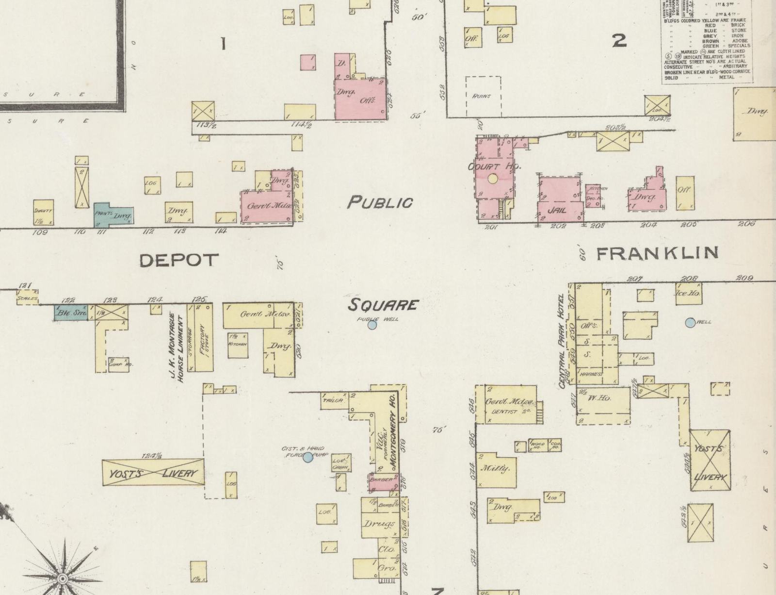
1792
Town established
By the General Assembly, November 10
180
Acres in the first town
County land, laid off in lots and streets
264
Feet across the public square
Where Main and Cross streets meet
23,348
Residents
2020 Census
Chapter 1
1776 to 1792
A court on a meadow.
Christiansburg exists because Montgomery County needed a courthouse near its middle. The county was formed in 1776 out of Fincastle County, and it was much larger then. In 1789 the General Assembly cut a new county, Wythe, from its western end, and told Montgomery’s justices to meet the next May at the house of James Craig and choose a place for the court as near the center of the county as they could.
After Wythe County took effect in 1790, the court moved to James Craig’s house and tavern at Hans Meadow. Craig gave the county title to land for the public buildings, and on May 21, 1790, the new town was surveyed.
The General Assembly made it official on November 10, 1792. Its act established as a town 180 acres belonging to Montgomery County, where the courthouse and the other public buildings stood, “already laid off into lots and streets,” by the name of Christiansburg, with nine trustees in charge. Most historians believe the town was named for Colonel William Christian, a justice of the county from 1779, who was killed in 1786.
Chapter 2
1790 to today
The public square.
The plan was as simple as a town plan can be. Main Street and Cross Street, now Franklin Street, were laid out 60 feet wide, and where they crossed they opened into a public square 264 feet across, with a block of town lots on each corner. The oldest known map of the town, probably drawn in 1806, is in the town’s minute book of that year, now at the Montgomery Museum. It shows the square clearly marked and still empty.
After several years in temporary quarters, the county built a brick courthouse in the center of the square in 1808 and rebuilt it about 1815. In 1836 a new courthouse went up on the square’s southeast quadrant, and the building in the middle was removed. That site held the courthouse for more than 140 years: a new one replaced the 1836 building there in 1909, and it stood until 1979, when the county built a courthouse on the lot next door to the east. The present courthouse, farther east on Main Street, opened in 2012.
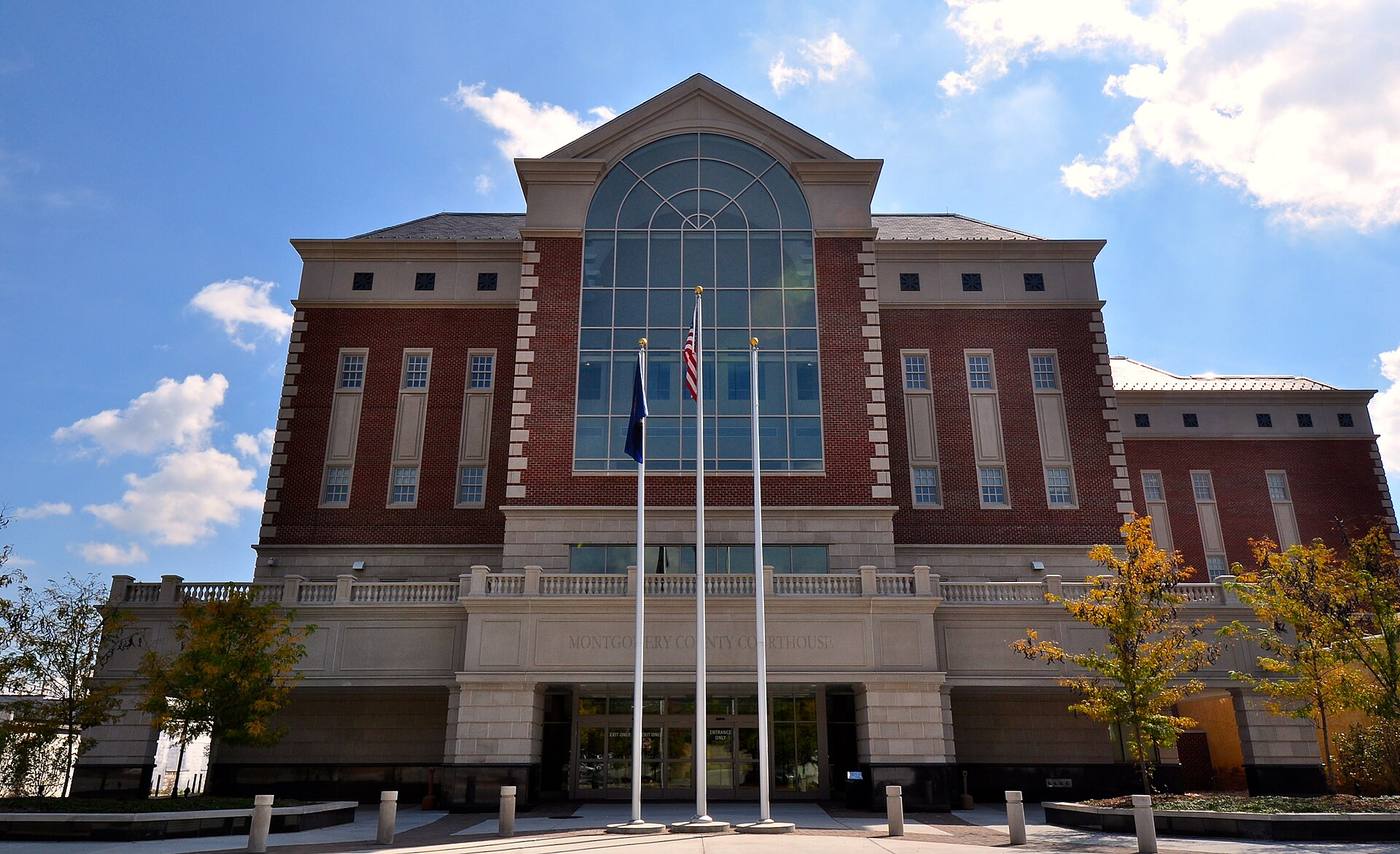

The county’s records stayed on the square as well. A two-room clerk’s office of 1812 was later built into the Phlegar Building, which the county took down in 2020 to make room for a magistrates’ building. A public well in the square was in use until the 1930s.
Today paved streets and parking cut the square into its four quadrants, three of them grassed and one the plaza of the 1979 courthouse. Its shape is still the one on the map of 1806.
Chapter 3
1775 to 1860
Where the roads met.
Christiansburg grew up on the main road west. The western branch of the Great Wagon Road, which ran from Philadelphia toward the backcountry of the Carolinas and Georgia, crossed the New River Valley, and that branch became known as the Wilderness Road. After Daniel Boone and others improved it about 1775, it was the main route of migration to Kentucky and the West through the Cumberland Gap. Its route climbed the Allegheny Mountains at Christiansburg and crossed the New River at Ingles Ferry, a state historical marker records. Main Street is that road, the one the Town’s history calls the Great Wilderness Road; today it is U.S. Route 11.
Travelers made the town’s first business. In 1793 five householders were licensed to keep ordinaries, the taverns of the day. When the French prince Louis Philippe, later King of the French, passed through in April 1797, he found a village of about ten houses.
Other roads came to meet the Great Road. From 1806 to 1809 the Alleghany Turnpike was built from Salem to Christiansburg, a market route east. The cross street ran south toward the Little River, the label South Franklin Street once carried, and north, after the 1850s, toward the railroad depot. About 1855 the Jacksonville and Christiansburg Turnpike, running north and south, crossed the railroad at the depot, and in the 1850s the Yellow Sulphur Turnpike, today’s Cambria Street, was built from the depot toward the springs resort. Peppers Ferry Road, now Route 114, is named for a ferry crossing that Samuel Pepper set up in the 1770s.
The town filled in along its two streets. It was incorporated in 1833, with trustees, and an act of 1861 gave it elected officers. In 1835 it had 335 people, 45 houses and 5 stores. In 1852 Henry Howe’s Historical Collections of Virginia placed Christiansburg 203 miles southwest of Richmond on the main stage road from Richmond to Nashville, with 4 stores, 2 churches and about 400 people. The Bank of the Valley opened in 1853 in a two-story brick building facing the square, and the brick Presbyterian church was built the same year.
The folk artist Lewis Miller visited a cousin here four times between 1846 and 1871 and sketched the town. His drawings and an 1855 painting by Edward Beyer show buildings only along Main and Franklin streets.
Chapter 4
1810 to 1929
Yellow Sulphur Springs.
About three and a half miles north of the courthouse, between Christiansburg and Blacksburg, is one of the most complete early spa resorts left in Virginia. It was known by 1810, when a letter to the Richmond Enquirer described Taylor’s Spring, or the Yellow Spring, on land owned by Charles Taylor: water between 54 and 55 degrees, led through wooden channels for the drinkers, and a climate the writer thought second to none.
The resort grew with the railroad. By the 1850s, as Yellow Sulphur Springs, it drew guests such as Edmund Ruffin, Jubal Early and P. G. T. Beauregard, and some built cabins of their own; Early’s stood until 1943. Guests came by rail to the depot at Cambria, the transfer point for the springs. The resort closed during the Civil War and was running again by 1869. In 1871 new owners paid $25,000 for it, built a mansard-roofed hotel, put galleries on the cottage rows and refitted the bowling alley, and during those years the trustees of the Virginia Agricultural and Mechanical College, now Virginia Tech, met at the springs to organize the college.
A fire destroyed the new hotel in 1883. After 1886 a large Shingle Style hotel went up, and the springs had another popular run that lasted until 1923.
In 1926, during the years of segregation, ten Black businessmen with deep ties to Roanoke, among them the filmmaker Oscar Micheaux, formed Yellow Sulphur Springs, Inc. and bought the closed resort. It opened on June 1, 1926, with 53 acres, a three-story hotel and more than 71 cottages, and was advertised as America’s Greatest Colored Mountain Resort, with package rates on the railroads from Tidewater. It closed in 1929 and was sold at auction, but it may have been the largest African American-owned resort in the nation in its time.
The original hotel of the early 1800s, with its galleried front of the mid-1800s, still stands, restored in the 1990s, along with three cottage rows, an early bowling alley and a many-sided gazebo over the spring. It was listed on the National Register in 1979, and its story from 1926 to 1929 was added to the listing in 2013.
Chapter 5
1851 to 1965
The railroad and Cambria.
The railroad did not come to the square. In 1851 the Virginia and Tennessee Railroad chose a site along Crab Creek about a mile north of the courthouse, where the grades allowed it. The tracks reached the depot in 1854, and a permanent station followed in 1857. In 1864 Union troops burned the depot complex. Its replacement, built by the railroad about 1869, still stands on Depot Street: one of only two known railroad buildings from the Reconstruction years left in Southwest Virginia.
A village grew up around the station. It got a post office in 1873 and the name Bangs, became Ronald in 1885, and in 1892 took the name Cambria, from the rock formation beneath it. The depot was the transfer point for guests bound for the Yellow Sulphur Springs resort, and a turnpike ran from the station to the springs along what is now Cambria Street.
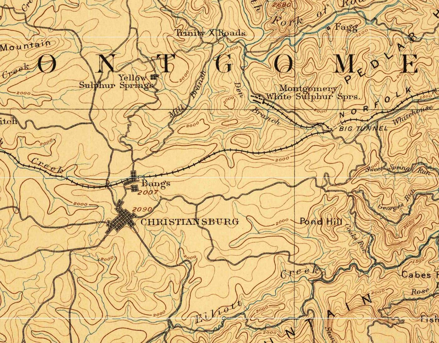
Cambria was incorporated as a town of its own in 1906, the year the railroad built a new passenger station a short way east and turned the old depot into a freight station. In 1908 a wholesale grocery and the Bank of Cambria went up facing the depot square; together they are the Surface-Lee Block. By 1913 a lumber company, a furniture factory and a flour mill worked near the tracks. Upstairs over a Cambria drugstore was the county’s first hospital. Farmers from Floyd County came north to Cambria to trade.
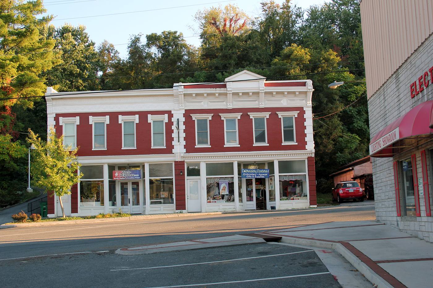

Fires in 1947 and, by the Town’s account, 1959 destroyed some of Cambria’s oldest commercial buildings. The two towns then became one: the state’s charter record dates the consolidation to 1964, and the Town’s history to December 31, 1965. Cambria’s depot square, its storefronts and its houses on Depot, Montgomery and Cambria streets are now the Cambria Historic District.
Chapter 6
1700s to 1987
Mills, tanneries and factories.
Christiansburg was a market town for farms, and its first industries worked what the farms produced. By the Town’s account, the Gardner Zink Mill west of town and the Chrisman Mill on Crab Creek, on what is now Chrisman Mill Road, gathered much of the area’s milling in the late 1700s. Livestock were driven down Main Street to market or to the depot, which by the early 1900s was the main shipping point for much of Montgomery County.
The fire insurance map of December 1885 shows what the town made then. A quarter mile southwest of the courthouse was the South West Virginia Tannery of Stone, Spindle and Company, with its bark sheds and vats; half a mile north, beside the railroad, the Montgomery Roller Mill Company ground flour. The tannery ran on four hands, used tan bark for fuel and drew its water from a spring. Facing the square was a building labeled for J. K. Montague’s horse liniment, which the Montague family made in town, and in the early 1900s stockyards stood at the end of Park Street.
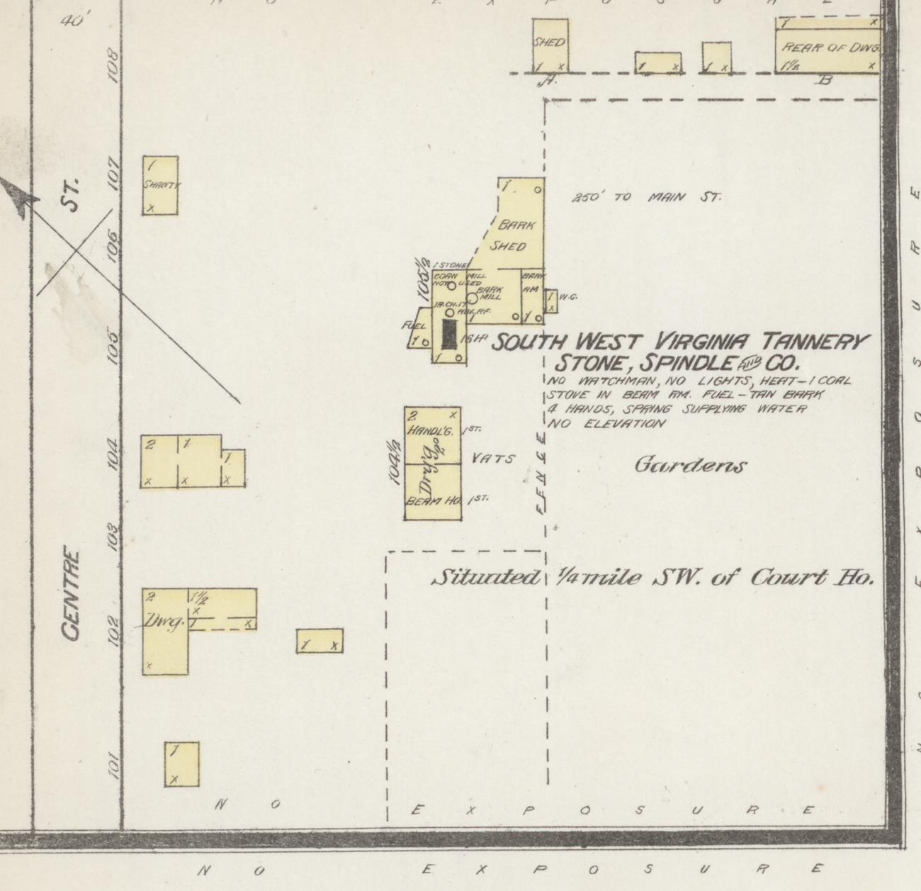
By 1921 the maps list three flour mills, two planing mills, a furniture factory, a canning factory, a bottling works and ice factory, lumber yards and two auto repair shops, many of them near the tracks at Cambria.
After World War II, by the Town’s account, the town industrialized quickly; among the new plants was a Southern Dairies plant. By the mid-1980s the land the town proposed to annex included an idle Corning Glass Works plant, and boundary adjustments in the 1990s brought the Falling Branch Industrial Park and the Christiansburg Industrial Park into the town, by the Town’s account.
Chapter 7
1866 to 1966
Christiansburg Institute.
In 1866, the year after the Civil War ended, Captain Charles S. Schaeffer, an agent of the Freedmen’s Bureau, began teaching freedpeople in Christiansburg. It was five years before Virginia had public schools. With help from the Friends’ Freedmen’s Association of Philadelphia, a Quaker group, the school added a normal school building in 1873, and in 1885 it built the Hill School, a brick building on a high point overlooking the town. The Hill School still stands on High Street, between downtown and Cambria.
In 1895 the Friends asked Booker T. Washington to supervise the school, and it was reorganized on the model of Tuskegee and Hampton, with a Tuskegee graduate as principal from 1896. Washington remained its supervisor until his death in 1915. The school bought farmland on Crab Creek west of the Hill School in 1898, 1899 and 1905, and built a campus there with dormitories, a dairy and a barn, where students worked the farm and learned trades.
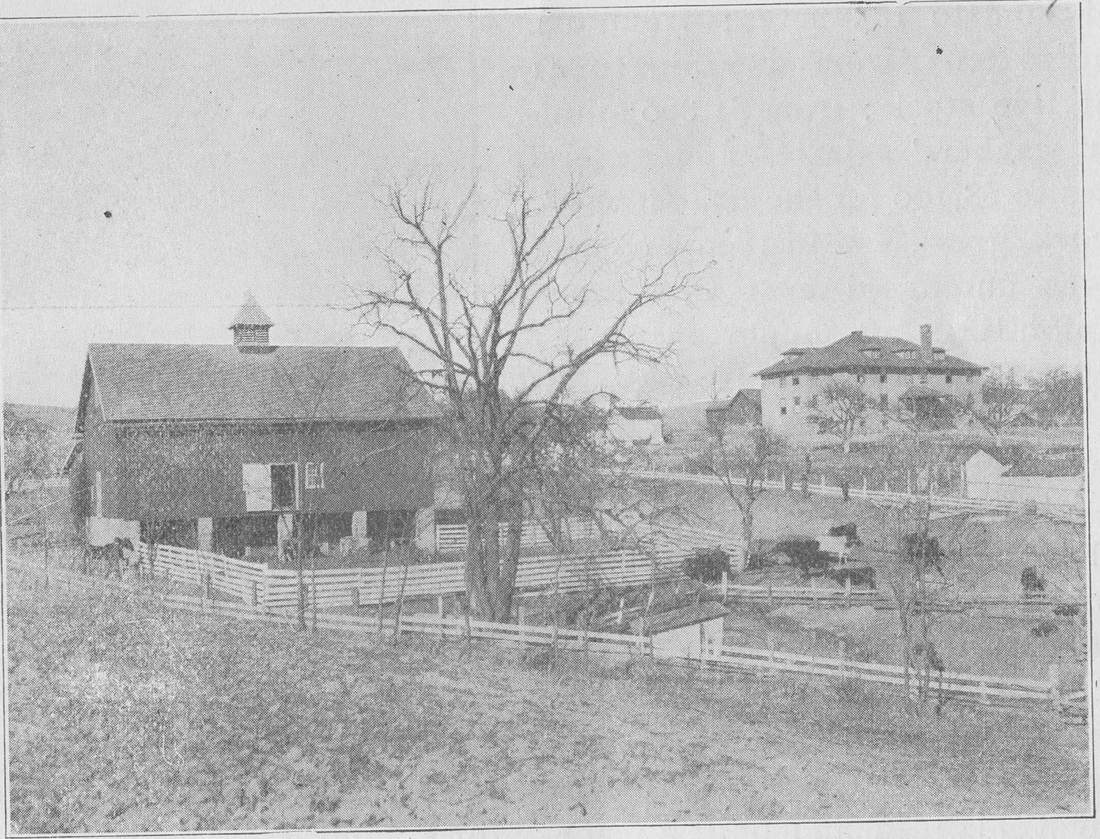

Its centerpiece, the Edgar A. Long Building, was begun in 1927 and opened for classes in December 1928, named for the principal who led the school from 1906 to 1924. In 1932 the Institute was accredited as a four-year high school, one of three Black high schools in Virginia with that standing.
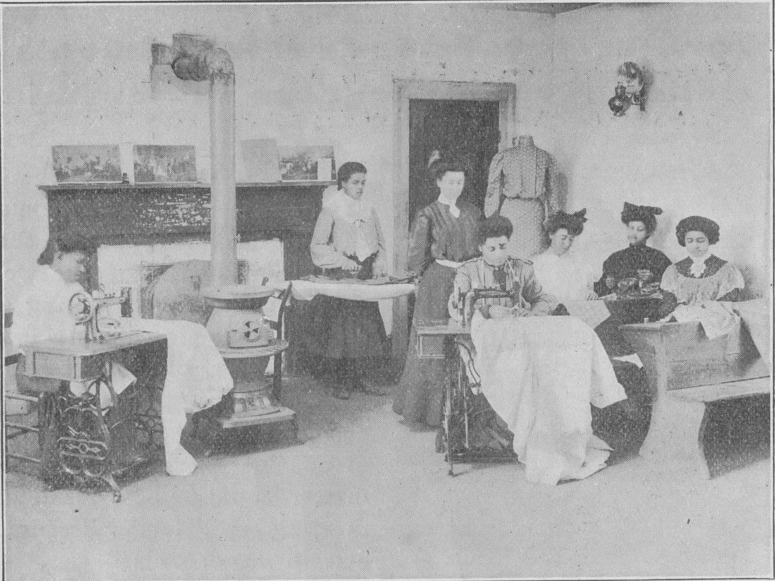

The county began leasing the school in 1934. In 1947 the campus was deeded to the school divisions of Montgomery County, Radford and Pulaski County, and it served as the high school for Black students from all three, under the name Christiansburg Institute from 1950. When the county’s schools were desegregated, the last class graduated in the spring of 1966, and the campus was sold in 1967.
The Hill School was listed on the National Register of Historic Places in 1979 and the Long Building in 2001. The school’s alumni founded Christiansburg Institute, Inc., which keeps its history, its archives and a museum.
Further reading: Christiansburg Institute, Inc. (museum and archives)
Chapter 8
1900 to 1966
A county seat grows.
The new century started fast. Between 1900 and 1910 the town grew from 659 people to 1,568, probably on the strength of industry near the railroad, and new houses went up between the town and the depot. A souvenir booklet of 1907 claimed the town had almost tripled in population and property values. In March 1912 the town opened its own water system, fed by springs, which also served Cambria.
Then came the automobile. The Lee Highway, U.S. 11, was hard-surfaced through downtown in 1926, and by 1928 a dozen businesses sold or served cars. That year 42 merchants did $1,444,500 in business, against $874,000 in Blacksburg.
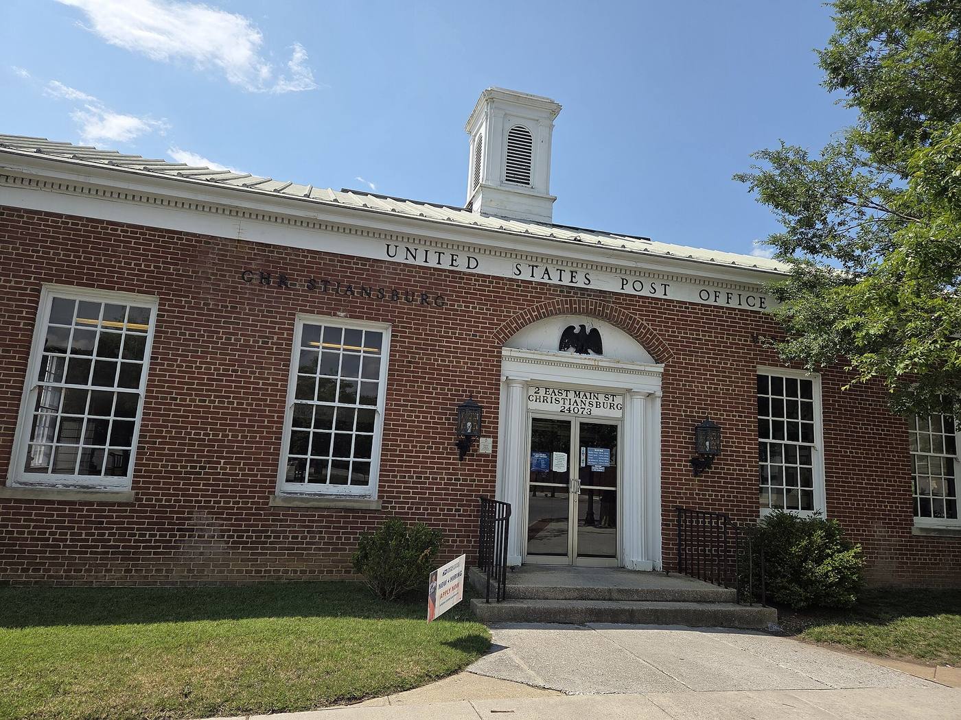
The post office on East Main Street was begun in 1936, and in 1938 and 1939 the artist John W. de Groot painted a New Deal mural of the Great Road for its lobby.
.jpg)
After World War II, cars and better roads brought shoppers from across the region. Christiansburg and Cambria together sold more than $8 million at retail in 1951. In 1956 the town adopted a council-manager government. Fires in 1954, 1956 and 1957 took a string of downtown businesses.
Desegregation came to the town’s schools in the 1960s. Christiansburg High School enrolled its first Black students in 1965, and the county’s schools were fully desegregated in 1966.
Chapter 9
1969 to 2020
From the square to the mall.
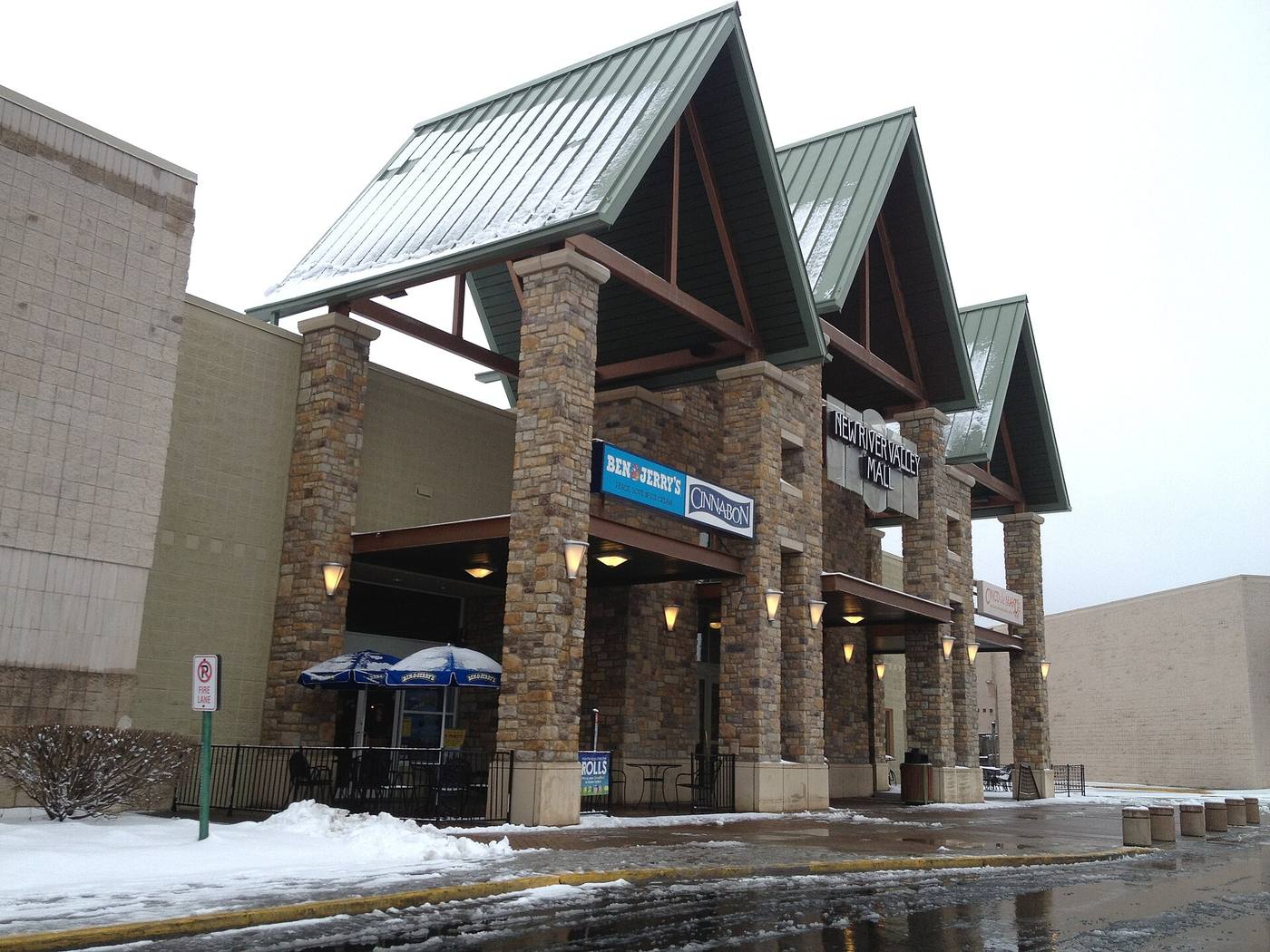
In the second half of the century, shopping moved out from the square. The town’s first shopping center, Hill’s Plaza, opened on October 15, 1969, on Roanoke Street about a mile east of downtown. Rose’s closed its downtown store in the late 1970s, and downtown answered with the Old Town Mall in the mid-1980s. In 1988 Leggett’s department store moved from downtown to the newly built New River Valley Mall north of town.
.jpg)
The town grew to meet the new stores. In 1975 it annexed 3.03 square miles, adding 1,072 people. In 1986 it asked to annex another 7.96 square miles in three parcels, land that held about 13 subdivisions, a shopping mall under construction, an idle glass plant and a good deal of farmland. The state’s Commission on Local Government reviewed the case in 1987 and recommended a somewhat smaller area. By the Town’s account, the annexation that took effect in 1988 took in Belmont Farms, the mall site, the former Virginia Tech horticulture farm and the top of Christiansburg Mountain, and boundary adjustments in the 1990s and 2000s added industrial parks, more of the shopping district, and in 2009 the middle school and the Harkrader Sports Complex.
The shopping district along North Franklin Street and Peppers Ferry Road kept growing: Spradlin Farms from 2000 and the New River Center in 2007, by the Town’s account. The town’s Recreation Center opened on North Franklin Street in 1997. In 2020 the mall’s owner renamed it Uptown Christiansburg.
Chapter 10
1989 to today
Christiansburg today.
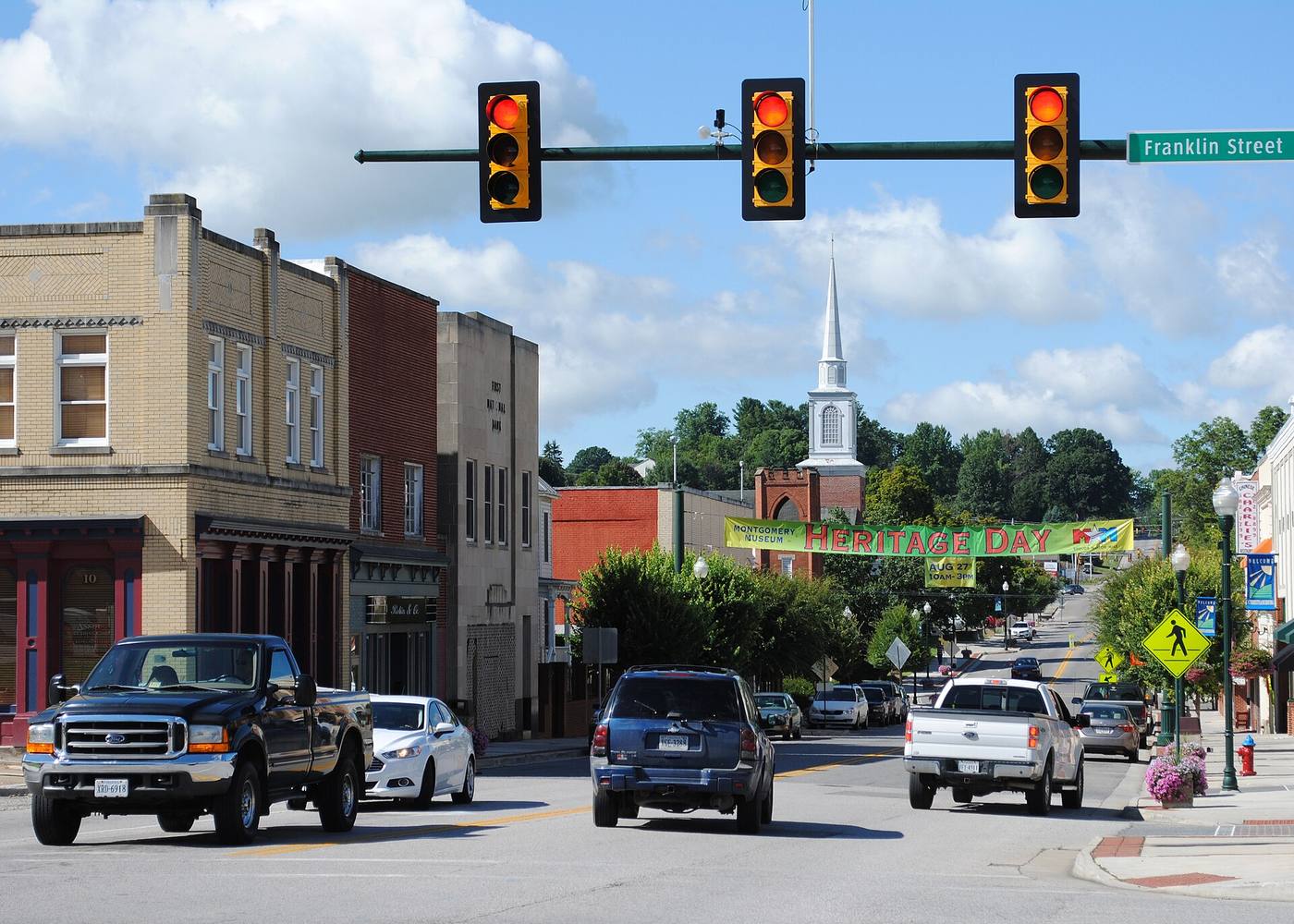
The oldest parts of town are on the state and national registers, though the Town sets no design rules for them. The East Main Street, South Franklin Street and Cambria historic districts were listed on the Virginia Landmarks Register in 1989 and the National Register of Historic Places in 1991, and the Downtown Historic District followed in 2013.

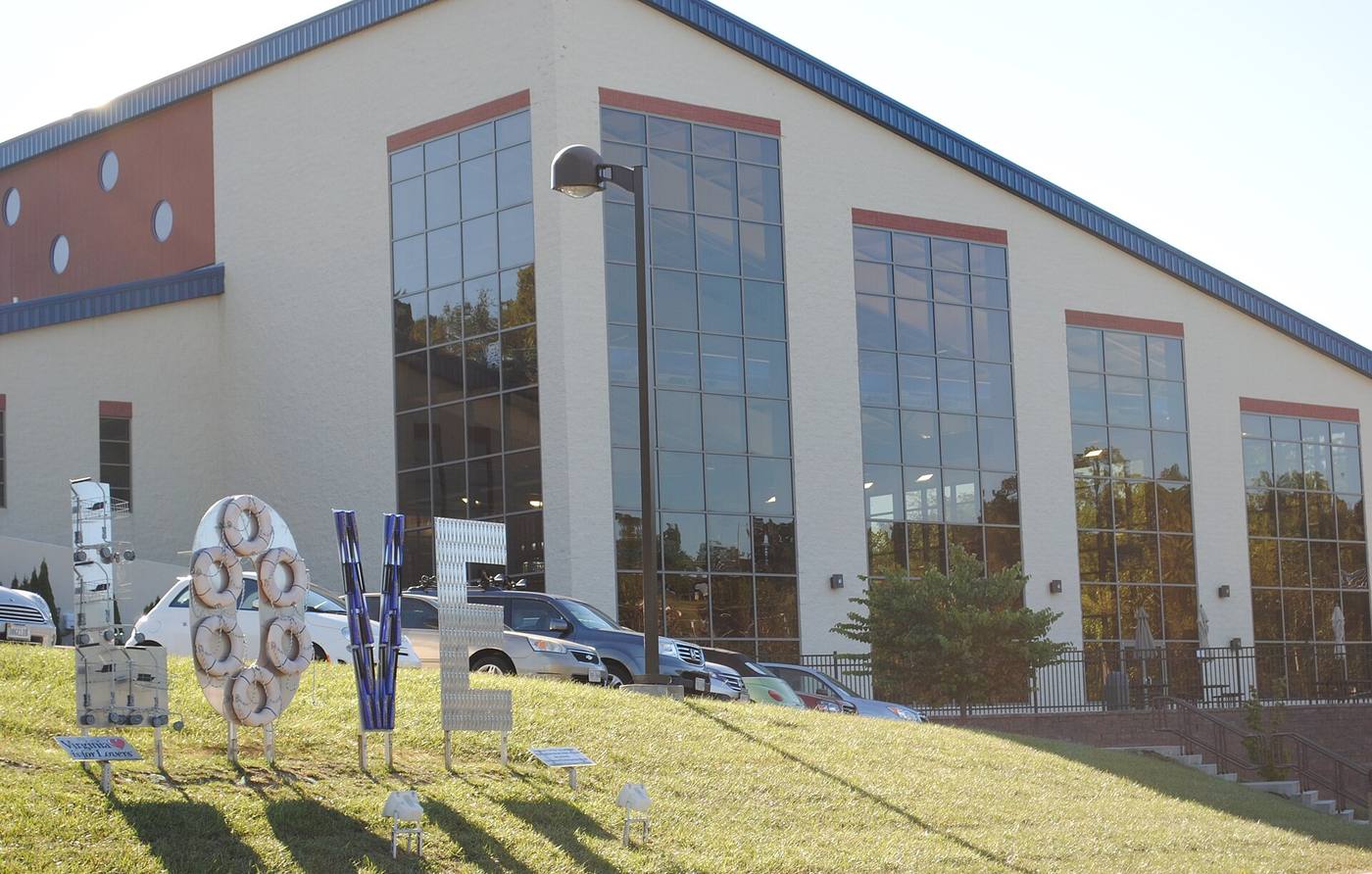
The town has built for recreation. The Christiansburg Aquatic Center opened in July 2010, a $19 million building with a 50-meter competition pool added to meet Virginia Tech’s needs, with the university paying the added $2 million.

The Huckleberry Trail now runs from Blacksburg to Christiansburg High School; its newest section, to the high school, was finished in May 2020. In 2013 the town bought 63 acres of farmland off Peppers Ferry Road, and in 2023 it opened there as Christiansburg Huckleberry Park.
And the railroad is coming back to Cambria. Ground was broken there in April 2025 for a passenger rail station, the first passenger service in the New River Valley since 1979, with trains planned as early as 2027.
See what's coming to Christiansburg: new development and projects in the works, and follow what Town Council is deciding.
By the numbers
Christiansburg by the numbers.
How many people lived in the town at each census, from 1870 to 2020.
The town was not counted on its own in 1890. The 1970 count includes Cambria, which joined the town in the mid-1960s, and land annexed in the 1960s: 4,236 of the 7,857 people lived in areas added since 1960. The Census Bureau estimates 22,442 people as of July 1, 2025.
Cambria, a town of its own until 1964
- 1910
- 535 people
- 1930
- 673 people
- 1950
- 853 people
- 1960
- 722 people
Timeline
Christiansburg, year by year.
From the first court day to the passenger rail station.
Before 1800
1775
The Wilderness Road
Daniel Boone and others improve the road west that climbs the Alleghenies at Christiansburg.
1776
Montgomery County
The county is formed out of Fincastle County.
1789
Find the center
The county’s justices are told to meet at James Craig’s house and choose a court site near the county’s center.
1790
Hans Meadow
The court moves to Craig’s house and tavern; the new town is surveyed on May 21.
1792
A town
The General Assembly establishes Christiansburg on November 10: 180 acres of county land.
1797
About ten houses
Louis Philippe, later King of the French, passes through.
The 1800s
1806
The first map
The town’s minute book shows the square, and the turnpike from Salem is begun.
1808
A courthouse
A brick courthouse goes up in the center of the square.
1810
Taylor’s Spring
A Richmond newspaper describes the spring that becomes Yellow Sulphur Springs.
1812
The clerk’s office
A two-room clerk’s office is built for the county’s records.
1833
Incorporated
The town is incorporated, with trustees.
1836
The southeast quadrant
A new courthouse is built on the square’s southeast quadrant.
1853
A bank on the square
The Bank of the Valley opens.
1854
The railroad
The Virginia and Tennessee reaches its depot a mile north of town.
1864
The depot burns
Union troops burn the depot complex; it is rebuilt about 1869.
1866
A school
Teaching begins at what becomes Christiansburg Institute.
1871
A new resort
Yellow Sulphur Springs is rebuilt; the trustees of the new land-grant college meet there to organize it.
1885
The Hill School
The Institute’s brick school is built above the town.
1885
On the map
The first fire insurance map shows a tannery, a roller mill and 750 people.
1892
Cambria
Bangs, then Ronald, takes the name Cambria.
The 1900s
1906
Two towns
Cambria is incorporated; a new passenger station opens.
1909
A new courthouse
The 1836 courthouse is replaced on the same site.
1912
Town water
A spring-fed water system serves Christiansburg and Cambria.
1926
The Lee Highway
U.S. 11 is hard-surfaced through downtown.
1926
A resort reopens
Ten Black businessmen from Roanoke reopen Yellow Sulphur Springs, until 1929.
1928
The Long Building
Christiansburg Institute’s new building opens for classes.
1936
The post office
The post office on East Main Street is begun.
1947
A public school
The Institute’s campus is deeded to three public school divisions.
1953
The Starlite
The Starlite Drive-In opens east of town.
1956
A town manager
The town adopts council-manager government.
1965
One town
Christiansburg and Cambria are consolidated (1964 by the state’s record, December 31, 1965 by the Town’s).
1966
The last class
Christiansburg Institute closes as the county’s schools desegregate.
1969
Hill’s Plaza
The town’s first shopping center opens on Roanoke Street.
1975
Annexation
The town annexes 3.03 square miles and 1,072 people.
1979
The courthouse moves
The 1909 courthouse is razed for a new one next door.
1979
Yellow Sulphur Springs
The resort is listed on the National Register.
1988
The mall
Leggett’s leaves downtown for the new New River Valley Mall.
1991
Historic districts
East Main Street, South Franklin Street and Cambria join the National Register.
1997
The Recreation Center
The town opens its Recreation Center on North Franklin Street.
The 2000s
2010
The Aquatic Center
A 50-meter pool opens, built with Virginia Tech.
2012
Today’s courthouse
The county opens its new courthouse on East Main Street.
2013
Downtown and a park
Downtown joins the National Register; the town buys the land for Huckleberry Park.
2023
Huckleberry Park
The park opens off Peppers Ferry Road.
2025
Back to the rails
Ground is broken for a passenger station at Cambria.
Sources
Every historical fact on this page comes from a source below, read on the date shown. Most come from the National Register of Historic Places nominations for Christiansburg’s historic districts and landmarks, the acts of the Virginia General Assembly, and Census Bureau publications. Where sources disagree or a record could not be checked, the fact is left out or the disagreement is noted. Census figures are the Census Bureau’s; sale prices come from local sales records. Something to add or correct? Tell us.
Every source was checked on October 14, 2026.
- Town of Christiansburg: Town History
- William Waller Hening, The Statutes at Large of Virginia, vol. 13 (1823): the 1789 act dividing Montgomery County (pp. 77-78) and Chapter 71 of the October 1792 session, an act for establishing several towns (p. 585)
- National Register of Historic Places nomination: Christiansburg Downtown Historic District (2013), Virginia Department of Historic Resources file 154-5025
- National Register of Historic Places nomination: South Franklin Street Historic District (Gibson Worsham; VLR 1989, NRHP 1991), Virginia Department of Historic Resources file 154-0010
- Virginia Department of Historic Resources: Phlegar Building (154-0007)
- Sanborn Map and Publishing Company, Christiansburg, Va., December 1885, 1 sheet (Library of Congress, Sanborn Maps Collection)
- Virginia Department of Historic Resources highway marker K-70, “Ingles Ferry Road” (1998), as transcribed by the Historical Marker Database (archived)
- Sharon B. Watkins, on Louis Philippe’s 1797 journey through Montgomery County, The Smithfield Review, vol. 16 (2012), pp. 15-16, citing his diary
- Henry Howe, Historical Collections of Virginia (1852), p. 385, Montgomery County, as transcribed by House Divided, Dickinson College
- National Register of Historic Places nomination: Cambria Historic District (Gibson Worsham; VLR 1989, NRHP 1991), Virginia Department of Historic Resources file 154-0048
- National Register of Historic Places nomination: Christiansburg Depot, now the Cambria Freight Station (1985), Virginia Department of Historic Resources file 154-0048-0001
- Wikipedia: Virginia State Route 114 (Peppers Ferry Road)
- Virginia Department of Historic Resources: Christiansburg Presbyterian Church (154-0003)
- Code of Virginia, Charters: Christiansburg (history of the town’s incorporation and charters)
- National Register of Historic Places nomination: Yellow Sulphur Springs (1979), Virginia Department of Historic Resources file 060-0013
- National Register of Historic Places: Yellow Sulphur Springs, additional documentation (2012; approved 2013), African American ownership 1926 to 1929
- Virginia Department of Historic Resources: Yellow Sulphur Springs (060-0013)
- U.S. Geological Survey, Christiansburg sheet, 1:125,000, 1890 (Historical Topographic Map Collection)
- National Register of Historic Places nomination: Surface House (1989), Virginia Department of Historic Resources file 154-0043
- U.S. Census Bureau, 1970 Census of Population, Vol. 1, Part 48 Virginia, Chapter A: Table 6, population of places, 1970 and 1960; Table 8, population of areas annexed between 1960 and 1970; Table 10 and its footnote on the Cambria consolidation
- Sanborn Map Company, Christiansburg, Montgomery County, Virginia, May 1921, sheet 1 (Library of Congress, Sanborn Maps Collection)
- National Register of Historic Places nomination: East Main Street Historic District (Gibson Worsham; VLR 1989, NRHP 1991), Virginia Department of Historic Resources file 154-0001
- Commission on Local Government, Commonwealth of Virginia: Report on the Town of Christiansburg-County of Montgomery Annexation Action (February 1987)
- National Register of Historic Places nomination: Old Christiansburg Industrial Institute (Hill School) (1979), Virginia Department of Historic Resources file 154-5004
- Virginia Department of Historic Resources: Old Christiansburg Industrial Institute (154-5004)
- National Register of Historic Places nomination: Edgar A. Long Building (2001), Virginia Department of Historic Resources file 154-5008
- Tracy A. Martin, Black Education in Montgomery County, Virginia, 1939 to 1966 (master’s thesis, Virginia Tech, 1996)
- Cardinal News: “Christiansburg Institute to host fundraiser, info session” (February 7, 2023)
- Christiansburg Institute, Inc.: museum and archives
- National Register of Historic Places nomination: U.S. Post Office, Christiansburg (1991), Virginia Department of Historic Resources file 154-0027
- Town of Christiansburg: Town Council
- U.S. Census Bureau, 1910 Census, Vol. III, Virginia: Tables 1 and 2, population of minor civil divisions and incorporated places (pp. 924 and 927)
- WDBJ7: “New River Valley Mall name is changing to Uptown Christiansburg” (July 21, 2020)
- Town of Christiansburg: Recreation Center
- Town of Christiansburg: Huckleberry Trail
- Town of Christiansburg: Historic Resources (the four National Register districts and their maps)
- Town of Christiansburg: Christiansburg Aquatic Center history
- Town of Christiansburg: Christiansburg Huckleberry Park, park history and future plans
- Virginia Tech News: groundbreaking for the New River Valley passenger rail station at Cambria (May 2, 2025)
- Virginia Passenger Rail Authority: New River Valley passenger rail station
- U.S. Census Bureau, 1880 Census, Vol. I: Table III, population of civil divisions less than counties, Virginia, 1880 and 1870 (p. 359)
- U.S. Census Bureau, 1900 Census, Vol. I: Table 5, population by minor civil divisions, 1890 and 1900, Virginia (p. 399)
- U.S. Census Bureau, 1930 Census, Vol. I, Virginia: Tables 4 and 5, population of minor civil divisions and incorporated places, 1910 to 1930 (pp. 1128 and 1132)
- U.S. Census Bureau, 1950 Census of Population, Vol. I, Virginia: Table 6, population of counties by minor civil divisions, 1930 to 1950
- U.S. Census Bureau, 1960 Census of Population, Vol. I, Part 48 Virginia: Table 7, population of counties by minor civil divisions, 1940 to 1960
- U.S. Census Bureau, 1990 CPH-2-48, Population and Housing Unit Counts, Virginia: Table 9, population and housing units, 1970 to 1990
- U.S. Census Bureau, data.census.gov: Christiansburg town, Virginia, 2000, 2010 and 2020 censuses (total population and housing units)
- U.S. Census Bureau, Vintage 2025 population estimates for incorporated places, Virginia (July 1, 2025)
Images
- Sanborn Fire Insurance Map from Christiansburg, Montgomery County, Virginia (1 sheet), detail, December 1885Library of Congress, Geography and Map Division, Sanborn Maps Collection. The content of the Library of Congress online Sanborn Maps Collection is in the public domain and is free to use and reuse.
- Montgomery County Courthouse - new, October 5, 2013Photo: Skye Marthaler, CC BY-SA 3.0, via Wikimedia Commons. Creative Commons Attribution-Share Alike 3.0 Unported (CC BY-SA 3.0), https://creativecommons.org/licenses/by-sa/3.0/
- USGS 1:125,000-scale Quadrangle for Christiansburg, VA, 1890, detail, 1890U.S. Geological Survey, Historical Topographic Map Collection. U.S. Geological Survey: USGS-authored or produced data and information are considered to be in the U.S. Public Domain. (Work of the U.S. federal government.)
- Cambria VA, on Depot Street, September 30, 2014Photo: AstaPro5, CC BY-SA 3.0, via Wikimedia Commons. Creative Commons Attribution-Share Alike 3.0 Unported (CC BY-SA 3.0), https://creativecommons.org/licenses/by-sa/3.0/
- Sanborn Fire Insurance Map from Christiansburg, Montgomery County, Virginia (1 sheet), detail of the tannery inset, December 1885Library of Congress, Geography and Map Division, Sanborn Maps Collection. The content of the Library of Congress online Sanborn Maps Collection is in the public domain and is free to use and reuse.
- View of the Barn, Stockyard and Dormitory, Christiansburg Industrial Institute, June 1907 (The Colored American Magazine, vol. 12, no. 6)The Colored American Magazine, 1907 (public domain), via Wikimedia Commons. Published in 1907, before 1931: public domain in the United States. Wikimedia Commons records it as Public domain.
- A class in sewing, Christiansburg Industrial Institute, June 1907 (The Colored American Magazine, vol. 12, no. 6)The Colored American Magazine, 1907 (public domain), via Wikimedia Commons. Published in 1907, before 1931: public domain in the United States. Wikimedia Commons records it as Public domain.
- Christiansburg Post Office (VA), July 7, 2025Photo: Aet28, CC0, via Wikimedia Commons. Creative Commons Zero, Public Domain Dedication (CC0 1.0), http://creativecommons.org/publicdomain/zero/1.0/
- New River Valley Mall, March 24, 2013Photo: Mike Kalasnik, CC BY-SA 2.0, via Wikimedia Commons. Creative Commons Attribution-Share Alike 2.0 Generic (CC BY-SA 2.0), https://creativecommons.org/licenses/by-sa/2.0/
- Downtown August 2016, August 22, 2016Photo: Cburgva, CC BY-SA 4.0, via Wikimedia Commons. Creative Commons Attribution-Share Alike 4.0 International (CC BY-SA 4.0), https://creativecommons.org/licenses/by-sa/4.0/
- Aquatics, September 14, 2015Photo: Cburgva, CC BY-SA 4.0, via Wikimedia Commons. Creative Commons Attribution-Share Alike 4.0 International (CC BY-SA 4.0), https://creativecommons.org/licenses/by-sa/4.0/